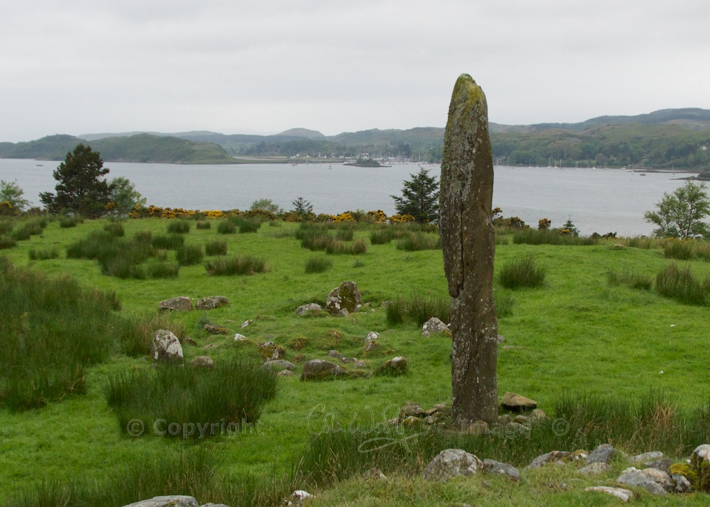
I don’t know how many times we must have driven past the standing stone at Kintraw in Argyll without seeing it.
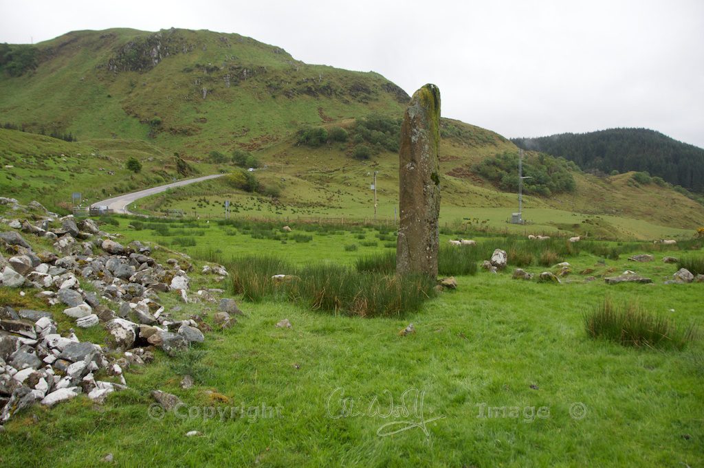
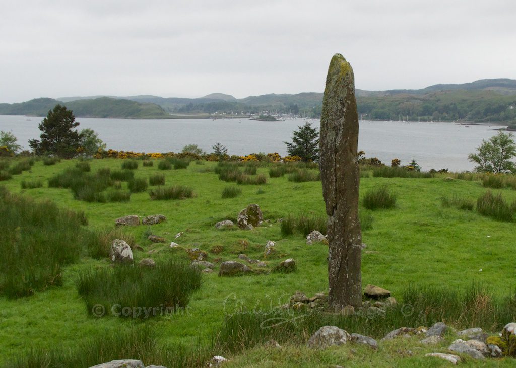
This is a shameful thing to admit, because it’s not hidden among trees, nor is it a rounded hump of a boulder like the stones at Fortingall in Perthshire. It stands alone and upright, all 13 feet of it, overlooking the wide expanse of Loch Craignish.
A few miles south of Kilmelford, the road snakes in a series of S-bends around the low hills, sea lochs and promontories that make the coast of Argyll so beautiful. Just as you’re climbing up from the shore of Loch Craignish, drag your gaze away from the lovely sea view and look to your left. The standing stone will surprise you, as it rises up finger-like from a farmer’s field.
When we last came this way it was beginning to rain. The mist was hugging the hills and blurring the lines between land and sea. It was soft rain, the kind that wets you thoroughly and makes every surface slippery to walk on. The sheep watched warily as I climbed over the gate.
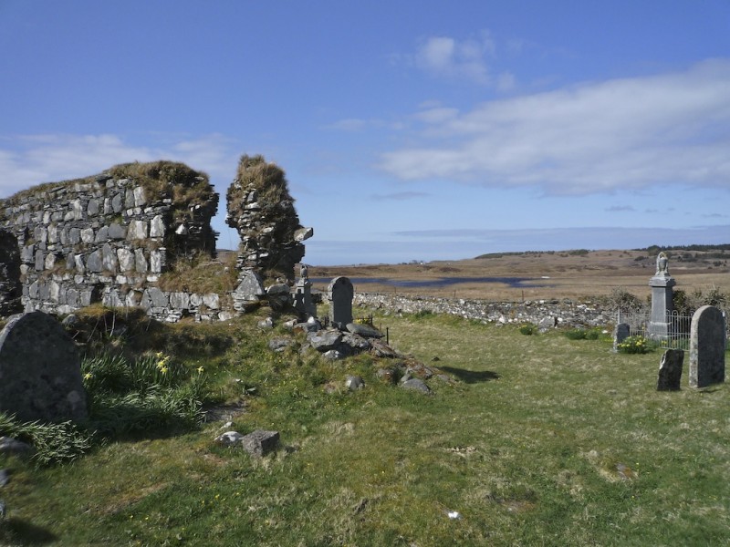
I had read next to nothing about this standing stone before visiting, so I didn’t know what to expect. It stands beside a rubble-strewn mound about 40 feet in diameter, which I recognised as a cairn similar to Dunchraigaig in Kilmartin Glen, but I totally missed the fact that there was another, smaller cairn just to the south-west.
Later, on reading up about the site, I found that there is, in addition, a ring of small stones to the north-west of the cairns, and a couple of large boulders which are thought to be the remnants of a four-stone alignment. That’s not to mention a scattering of other mounds in the vicinity that may once have been cairns, and the remains of a large hill fort known as Dun na Ban-Oige on the crag behind. Let’s face it, wherever you put your feet around here is a potential historical site!
But first, the monolith. Up close, it’s extremely impressive, and it must be one of the tallest standing stones I’ve seen outside of Callanish on the Isle of Lewis. The surface is rough with lichen, but I found no features except for a row of finger-sized holes which may just be a natural crack or seam that has been eroded with the weather. A couple of sources suggest they may be cup-marks, whose significance is now lost.
In the photo above, can you see an elongated face, viewed side on? Or have I been looking at it too long?
There wasn’t an information board (sometimes sites like these are much better without them) and the sheep weren’t giving anything away. Once they’d satisfied themselves that I hadn’t come to feed them, they lost interest rapidly. I wandered up and over the mound, photographing the wonderful backdrop of Loch Craignish which was gradually disappearing in the rain.
Echoes of a Norseman…
Looking at historical records, it appears that the standing stone was leaning over until 1979, when bad weather caused it to topple completely, revealing that a further three feet of its length had been buried below ground. Afterwards the stone was re-erected in the same socket, but on a slightly different axis. Luckily, records still exist of the stone’s original orientation, together with a report on the excavation of the mound which was done in 1959 by D D A Simpson.
And then, almost as an afterthought, tacked onto an archaeologist’s survey listed by the RCAHMS, comes this tantalising titbit: “The standing stone is said to have been erected to a Norse prince… and is known as the “Danish King’s Grave”, as also apparently is cairn A [the larger cairn].”
It’s amazing how much imagination can be stirred by just a scrap of folk memory!
What did the archaeologists find?
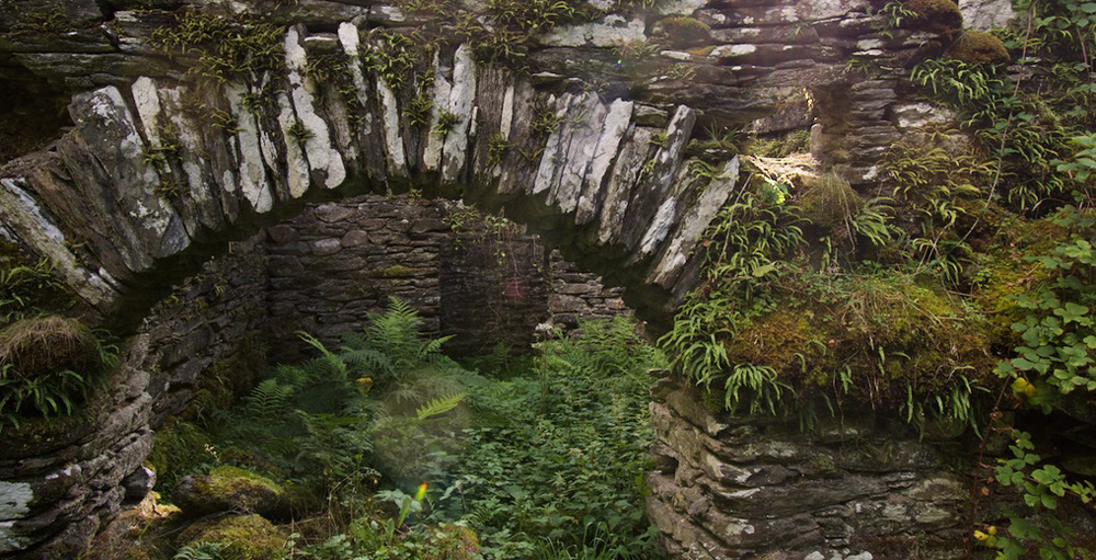
On the north-west edge of the mound they discovered a segmented burial cist which contained traces of cremated bone and carbonised wood. There was no evidence of any burial at the mound’s centre, but remnants of wood in this area suggested the existence of a wooden post. On the south-western edge a ‘false portal’, in other words a shallow opening that leads to nowhere, was discovered behind a large recumbent stone that may once have stood upright.
I believe the large kerb stone at lower right marks the rough location of the burial cist (now sealed)
Recumbent stone or fallen monolith marking the false portal
Finds from the mound included mussel and cockle shells, some teeth of an ox, sheep or goat, and six jet beads, along with a medieval bronze buckle. The RCAHMS warns that “none of these finds was necessarily contemporary with the cairn”, which it tentatively dates between 2000 and 1500 BC. Originally, the entire mound was likely to have been covered with stones of brilliant white quartz.
The smaller cairn
The smaller cairn is only 11 feet wide, consisting of an arrangement of stones so random that someone untrained in archaeology (like me!) could easily overlook them. When it was excavated, one of the marking stones was found to form the side of a small cist about eight inches square, which yielded only carbonised wood.
Astronomical alignments
A line can be drawn between the burial cist on the edge of the the large mound, the standing stone, and a point on the horizon where the sun sets at midwinter. This led the eminent historian Professor Alexander Thom to believe it was positioned so that people could observe the sun setting in a notch between the Paps of Jura at winter solstice, around 1750 BC. Thom was apparently so convinced about this theory that he described Kintraw as “one of the most important solstitial sites known to him.”
In practice, the mountains on the island of Jura would have been hidden from viewers standing on the cairn, because a low hill is in the way. Thom speculated that they may have climbed the hill behind the cairn in order to get a better view, allowing them to line up the mound, the standing stone and the notch.
Did they do this? The archaeologist Dr Euan MacKie thought it possible that they did. On the hillside he found what he described as a ‘viewing platform’:
“Excavations in 1970 and 1971… discovered an artificial platform of rubble, with a conspicuous observation point at one end of it, made from two massive boulders, at the exact spot predicted by the astronomical theory.”
(‘The Megalith Builders’, 1977)
This does make sense: after all, you can’t easily witness the sunset or sunrise over a monolith if you’re standing right next to it: far better if you extend the line back and place yourself a couple of hundred yards away. But archaeologists have since argued that the sun would not have set in the ‘Jura notch’ four thousand years ago, but to the left of it, as seen from Kintraw.
I wonder if we’re trying to be too specific, looking for precise mathematical solutions while totally missing the point.
Meanwhile, there are more alignments… A second midwinter sunset line can be drawn through the mound’s central post hole and the false portal. The post hole and the burial cist on its north-west edge are aligned with sunset at midsummer; a cist in the smaller cairn, the standing stone and the central post hole of the mound line up with midsummer sunrise, while in the other direction they point towards the sunset in early November and February, marking important festivals known as Samhain and Imbolc in the ancient calendar.
Enduring mysteries
There is no evidence that Kintraw was ever a passage tomb, where the first rays of sunrise would have shone directly through into a central chamber on a certain day each year, and in any case its location makes this physically impossible. And what was the false portal for? I have yet to find an answer. It’s also quite possible that monuments such as Kintraw were created to record a one-off alignment, preserving a moment in time that the builders considered auspicious, and they may not have been intended for repeated observations.
Finally, just to make the veil even mistier: Aubrey Burl, in ‘The Stone Circles of the British Isles’, speculates that the ‘outlier’ or standing stone at Kintraw may belong to the smaller cairn, with which it marks the midsummer sunrise, whereas the second, larger cairn was placed there at a later date, honouring the significance of an already ancient site. I find this idea quite convincing. It may even be that the larger cairn ‘grew’ out of a burial chamber the same size as its neighbour.
When you’re looking at sites like these, I think there’s a limit to what you can do with logic. Digging, testing and measuring can only tell us so much. A couple of thousand years ago, the thread of some ancient wisdom was broken and, like a guttering candle, the light eventually went out. But somewhere, deep in our DNA, we know the answers.
This was going to be a short article! Once the stones draw you in, there’s no looking back. I guess it goes to show that it’s always worth squelching around a sheep field in the rain.
‘The Stone Circles of the British Isles’ by Aubrey Burl
Do you love talking to stones?
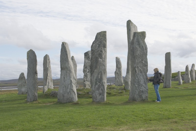
Callanish stone circle
If you love mysterious and ancient sites, take a look at these other features on The Hazel Tree. The first two are in Kilmartin Glen, just south of Kintraw.


 A line can be drawn between the burial cist on the edge of the the large mound, the standing stone, and a point on the horizon where the sun sets at midwinter. This led the eminent historian Professor Alexander Thom to believe it was positioned so that people could observe the sun setting in a notch between the Paps of Jura at winter solstice, around 1750 BC. Thom was apparently so convinced about this theory that he described Kintraw as “one of the most important solstitial sites known to him.”